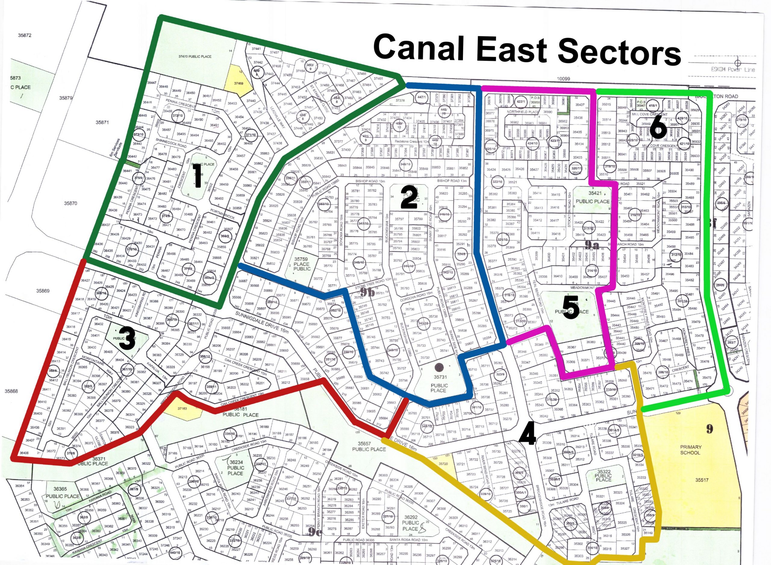
The Canal East area is divided up into 6 sectors. The map below will help you to determine which sector your property falls under. Should you not be able to find the information you need on the area map, the dropdown on the right of the map contains a list of which streets fall into each sector.
- Click on one of the sectors below to find your street -
Suningdale Drive, Kingsbarns Road, Ballybunion Crescent, Morfontaine Way, Breckenridge Road, Oak Creek Crescent, Sonoma Road, Stone Tree Road, Buckingham Road
Sunningdale Drive, Sunny Side Road, Medinah Road, Belmont Road, Breckenridge Road, Tulare Road, Tulare Crescent, La Contenta, Teal Bend Road, River Bend Road